Is Climate Change Supercharging El Niño? The Evidence, Explained
As a potentially record-breaking El Niño develops in 2026, scientists are debating whether global warming is intensifying the ocean phenomenon itself, or simply amplifying its destructive impacts.
By Factlen Editorial Team
- Impact & Adaptation Planners
- Meteorologists and civil planners focused on the downstream consequences of the weather.
- Climate Attribution Researchers
- Scientists focused on identifying the fingerprint of human activity in specific weather phenomena.
- Natural Variability Proponents
- Researchers emphasizing the long-term historical context of ocean cycles.
What's not represented
- · Agricultural economists
- · Insurance risk actuaries
Why this matters
El Niño fundamentally rewires global weather patterns, dictating everything from hurricane seasons to agricultural yields. Understanding whether these events are permanently intensifying helps governments and markets prepare for future droughts, floods, and food supply shocks.
Key points
- NOAA has confirmed the onset of El Niño conditions, with a 63% chance of a 'very strong' event by winter 2026-27.
- Scientists debate whether climate change is altering the fundamental mechanics of the El Niño ocean cycle.
- The IPCC notes there is no clear evidence that the ENSO cycle is intensifying beyond natural historical variability.
- However, there is absolute consensus that a warmer baseline atmosphere makes the impacts of El Niño much more destructive.
- The combination of global warming and a strong El Niño is expected to temporarily push global temperatures past the 1.5°C threshold.
The tropical Pacific Ocean is heating up rapidly, and a potentially historic El Niño is officially underway. The National Oceanic and Atmospheric Administration (NOAA) recently confirmed the onset of El Niño conditions, projecting a 63 percent chance that it will develop into a "very strong" event by the winter of 2026-27. Eastern Pacific sea surface temperatures are already registering anomalies of +2.1°C above the historical average, signaling a massive shift in oceanic heat distribution.[2]
This cyclical warming of the Pacific fundamentally rewires global weather. It typically brings heavy rainfall to the southern United States and the Horn of Africa, while triggering severe, prolonged droughts in Australia, Indonesia, and parts of the Amazon basin. Because the phenomenon alters the jet stream, it also suppresses hurricane formation in the Atlantic while fueling powerful cyclones in the central Pacific.[2][3]
As the 2026 event gains momentum, a vigorous debate is unfolding within the scientific community regarding the root cause of its severity. The core question is whether human-caused climate change is supercharging the El Niño phenomenon itself. Researchers are divided on whether the actual mechanics of the ocean oscillation are changing, or if the world is simply experiencing normal El Niños on a much hotter planet.[1]
To evaluate the evidence, it is necessary to separate the "engine" of El Niño from its "exhaust." The engine is the El Niño-Southern Oscillation (ENSO). Under normal conditions, persistent trade winds blow west across the Pacific, pushing warm surface water toward Asia and allowing cold, nutrient-rich water to upwell off the coast of South America. During an El Niño, these trade winds weaken, allowing the accumulated warm water to slosh back eastward.[2]

The first major claim in the scientific debate is that climate change is increasing the frequency and intensity of these ENSO ocean temperature swings. Some recent climate models and observational data suggest that the amplitude of sea surface temperature anomalies in the Pacific has grown larger over the past 50 years. Proponents of this view argue that the accumulation of greenhouse gases is altering the thermal gradients of the ocean, making it easier for extreme El Niño events to trigger.[1]
The first major claim in the scientific debate is that climate change is increasing the frequency and intensity of these ENSO ocean temperature swings.
However, the broader institutional scientific consensus urges caution on this specific claim. The Intergovernmental Panel on Climate Change (IPCC) Sixth Assessment Report concluded that there is currently "no clear evidence" of long-term trends in ENSO intensity that can be definitively distinguished from natural variability. The ocean's internal dynamics are highly complex, and models still struggle to perfectly simulate tropical Pacific cloud feedbacks in a warming world.[4]
Paleoclimate data—gathered from ancient coral reefs, tree rings, and sediment cores—shows that ENSO has always exhibited wild fluctuations in strength over the past 11,000 years. Because the reliable instrumental record of ocean temperatures only goes back a little over a century, distinguishing a permanent, climate-driven shift from a natural multi-decade cycle remains exceedingly difficult for oceanographers.[4]

The second major claim is that regardless of the ocean's internal mechanics, climate change is making the downstream impacts of El Niño significantly worse. On this point, the scientific consensus is absolute and uncontested. The World Meteorological Organization states that while the frequency of the ocean anomaly may not be changing, a warmer baseline atmosphere fundamentally amplifies the consequences of the weather it produces.[3]
The physics behind this consensus are straightforward: a warmer atmosphere holds exponentially more water vapor. When an El Niño event alters atmospheric circulation to dump rain on a specific region, that region now receives a supercharged deluge. The increased moisture availability turns what would have been a heavy seasonal rain into a catastrophic, infrastructure-destroying flood.[3]
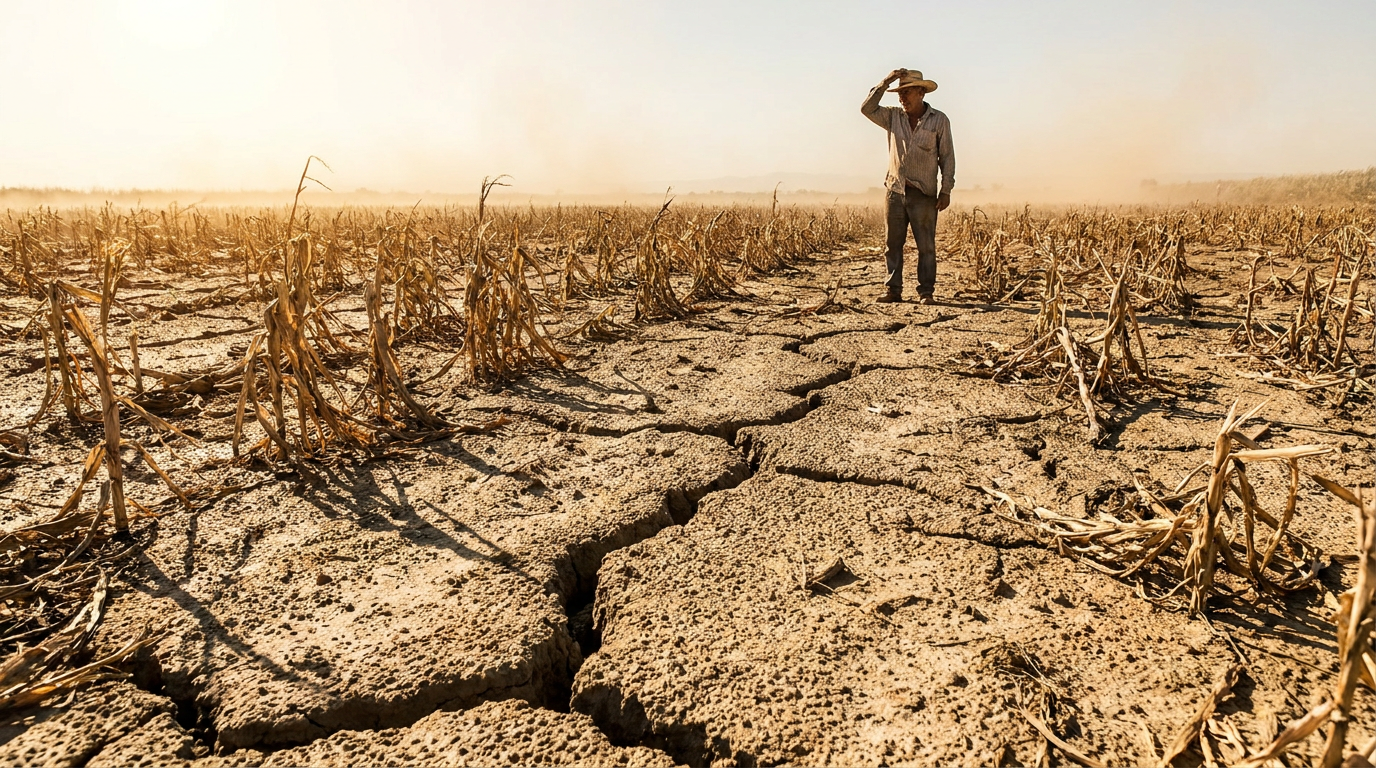
Conversely, in regions where El Niño induces drought, the baseline heat of a warming planet exacerbates the rapid drying of soil and vegetation. This compounding effect turns standard dry spells into severe agricultural crises and explosive wildfire seasons. Recent forecasts for Canada and Australia warn that the upcoming El Niño could trigger unprecedented fire conditions precisely because the land is already parched from baseline warming.[3][5]

The combination of a strong El Niño and baseline global warming is expected to push the planet into uncharted territory in the near term. Climate scientists project a high probability that the 2026-2027 period will temporarily breach the 1.5°C warming threshold set by the Paris Agreement. The heat released by the Pacific Ocean acts as a global furnace, temporarily spiking the Earth's average temperature.[5]
Ultimately, the distinction between a "supercharged El Niño" and "supercharged impacts" may matter more to academic oceanographers than to the general public. Whether the Pacific Ocean's temperature swings are naturally extreme or artificially enhanced, the resulting weather extremes are hitting a planet that is increasingly vulnerable to the shock. The focus for policymakers must remain on adapting infrastructure to survive these compounded extremes.[6]
How we got here
1997-1998
One of the most powerful El Niño events on record causes widespread global weather disruptions and massive coral bleaching.
2015-2016
Another 'super' El Niño pushes global temperatures to new highs, heavily influencing the urgency of the Paris Agreement.
2021
The IPCC AR6 report concludes there is no clear evidence that climate change is altering the frequency or intensity of the ENSO cycle itself.
June 2026
NOAA officially declares the onset of El Niño conditions, forecasting a high probability of a 'very strong' event by winter.
Viewpoints in depth
Climate Attribution Researchers
Scientists focused on identifying the fingerprint of human activity in specific weather phenomena.
This camp points to advanced climate modeling and recent observational trends to argue that greenhouse gas accumulation is altering the fundamental dynamics of the Pacific Ocean. They highlight that the upper ocean has absorbed massive amounts of heat, which they believe increases the 'fuel' available for ENSO swings, potentially making extreme El Niño events more frequent than in the pre-industrial era.
Natural Variability Proponents
Researchers emphasizing the long-term historical context of ocean cycles.
Relying heavily on paleoclimate data like tree rings and coral cores, these scientists argue that the Pacific Ocean has always undergone massive, erratic temperature swings. They caution against attributing recent strong El Niños directly to climate change, noting that the instrumental record is too short to distinguish a permanent anthropogenic shift from a natural multi-decadal cycle.
Impact & Adaptation Planners
Meteorologists and civil planners focused on the downstream consequences of the weather.
For this group, the debate over the ocean's internal mechanics is secondary to the reality on the ground. They emphasize that because the baseline atmosphere is now hotter and holds more moisture, any El Niño event will inherently produce more extreme heatwaves and heavier deluges. Their focus is on upgrading infrastructure and agricultural resilience to survive these compounded extremes.
What we don't know
- Whether the tropical Pacific cloud feedbacks will amplify or dampen ENSO swings in a +2°C world.
- Exactly how much of the current ocean heat anomaly is driven by short-term variability versus permanent climate shifts.
Key terms
- El Niño-Southern Oscillation (ENSO)
- The overarching cyclical climate pattern in the Pacific Ocean that includes both the warm phase (El Niño) and the cool phase (La Niña).
- Sea Surface Temperature (SST) Anomaly
- The difference between the current temperature of the ocean's surface and its long-term historical average.
- Trade Winds
- Persistent east-to-west winds that blow across the equatorial Pacific, which weaken significantly during an El Niño event.
- Paleoclimate Data
- Historical climate records derived from natural sources like tree rings, ice cores, and coral reefs, used to understand weather patterns before modern instruments existed.
Frequently asked
What exactly is El Niño?
El Niño is the warm phase of a natural climate pattern in the tropical Pacific Ocean, characterized by weakened trade winds and unusually warm surface waters off the coast of South America.
How often do El Niño events occur?
They typically occur every two to seven years and can last anywhere from nine months to several years.
Will this El Niño make 2026 the hottest year on record?
It is highly likely. The combination of baseline global warming and the heat released by a strong El Niño is expected to push global average temperatures to record highs, potentially breaching the 1.5°C threshold.
Does El Niño cause more hurricanes?
It depends on the region. El Niño typically increases hurricane activity in the central and eastern Pacific, but it creates atmospheric wind shear that suppresses hurricane formation in the Atlantic basin.
Sources
Source coverage
6 outlets
3 viewpoints surfaced


[1]The New York TimesClimate Attribution Researchers
Is Climate Change Supercharging El Niño?
Read on The New York Times →[2]NOAA Climate Prediction CenterImpact & Adaptation Planners
ENSO Alert System Status: El Niño Advisory
Read on NOAA Climate Prediction Center →[3]World Meteorological OrganizationImpact & Adaptation Planners
WMO Update: Prepare for El Niño
Read on World Meteorological Organization →[4]IPCCNatural Variability Proponents
Climate Change 2021: The Physical Science Basis
Read on IPCC →[5]Canadian GeographicImpact & Adaptation Planners
What do predictions of a strong El Niño event mean for Canada?
Read on Canadian Geographic →[6]Factlen Editorial TeamImpact & Adaptation Planners
Synthesis by Factlen editorial team
Read on Factlen Editorial Team →

Every angle. Every day.
Get science stories with full source coverage and perspective breakdowns delivered to your inbox.