How AI and Laser Technology Are Eliminating the Surprise of Severe Turbulence
Airlines are deploying real-time crowdsourced data, machine learning, and forward-looking lasers to detect invisible clear-air turbulence before aircraft encounter it. The new technologies promise smoother flights, fewer injuries, and reduced fuel consumption.
By Factlen Editorial Team
- Commercial Airlines
- Focuses on passenger safety, operational efficiency, and fuel savings by avoiding unnecessary altitude changes.
- Aerospace Engineers
- Prioritizes the development of hardware like LIDAR and automated flight control systems to physically counteract gusts.
- Aviation Meteorologists
- Emphasizes that climate change is increasing the frequency of clear-air turbulence, requiring better predictive modeling.
What's not represented
- · Flight Attendant Unions
- · Aviation Insurance Providers
Why this matters
Clear-air turbulence is becoming more frequent due to climate change, causing injuries and anxiety for millions of flyers. These predictive technologies not only make air travel significantly safer and more comfortable, but also help airlines reduce carbon emissions by optimizing flight paths.
Key points
- Climate change is increasing the frequency of invisible clear-air turbulence, prompting airlines to adopt new predictive technologies.
- Software platforms are using iPad accelerometers to turn commercial fleets into a massive, real-time weather sensor network.
- Machine learning algorithms analyze millions of live data points to forecast rough air before planes fly into it.
- Aerospace engineers are testing forward-looking LIDAR lasers to detect invisible wind shear up to 12 nautical miles ahead.
- Beyond improving passenger safety, avoiding turbulence helps airlines maintain optimal altitudes and significantly reduce fuel consumption.
For decades, the sudden, violent jolt of clear-air turbulence has been the most unpredictable hazard in commercial aviation. Unlike thunderstorms, which appear as bright red blobs on cockpit weather screens, clear-air turbulence is entirely invisible to traditional radar. Driven by shifting jet streams and climate change, these invisible air pockets are becoming more frequent; researchers at the University of Reading found that severe turbulence over the North Atlantic has increased by 55% since 1979.[2]
Historically, pilots relied on a reactive system of pilot reports—radioing back and forth to warn trailing aircraft of rough air. Today, the aviation industry is moving from reaction to prediction, deploying a sophisticated web of artificial intelligence, crowdsourced accelerometer data, and forward-looking lasers to map the invisible sky.[1][5]
The most immediate breakthrough is happening in software. Platforms like the International Air Transport Association’s (IATA) Turbulence Aware program are turning entire fleets into a synchronized, flying weather network. In the first half of 2025 alone, participating airlines generated nearly 25 million live turbulence reports, a 23% increase from the previous year.[1][3]

To gather this massive volume of data without requiring expensive new hardware, tech companies like SkyPath have developed clever workarounds. By tapping into the accelerometers built into the iPads that pilots already use in the cockpit, the software translates the physical shaking of the tablet into precise, real-time turbulence measurements.[1][2]
These measurements are standardized using the Eddy Dissipation Rate (EDR), a universal metric that quantifies the intensity of atmospheric turbulence regardless of the aircraft's size. A heavy Boeing 777 and a smaller Airbus A320 will react differently to the same patch of rough air, but EDR calculates the absolute atmospheric energy, allowing algorithms to normalize the threat for any plane flying behind them.[1][3]
This live data is then fed into machine learning models. Southwest Airlines, working with the National Center for Atmospheric Research, utilizes a system called Graphical Turbulence Guidance. By digesting historical turbulence patterns and real-time atmospheric data, the AI can predict where clear-air turbulence will form over notoriously unstable regions, such as the Rocky Mountains.[4]
Major international carriers are already seeing the benefits. Emirates recently integrated SkyPath, IATA's database, and Lufthansa Systems' Lido mPilot to give crews high-resolution, predictive weather maps. The airline reports a significant, measurable reduction in unexpected severe turbulence encounters since deploying the multi-layered system.[1][2]
Major international carriers are already seeing the benefits.
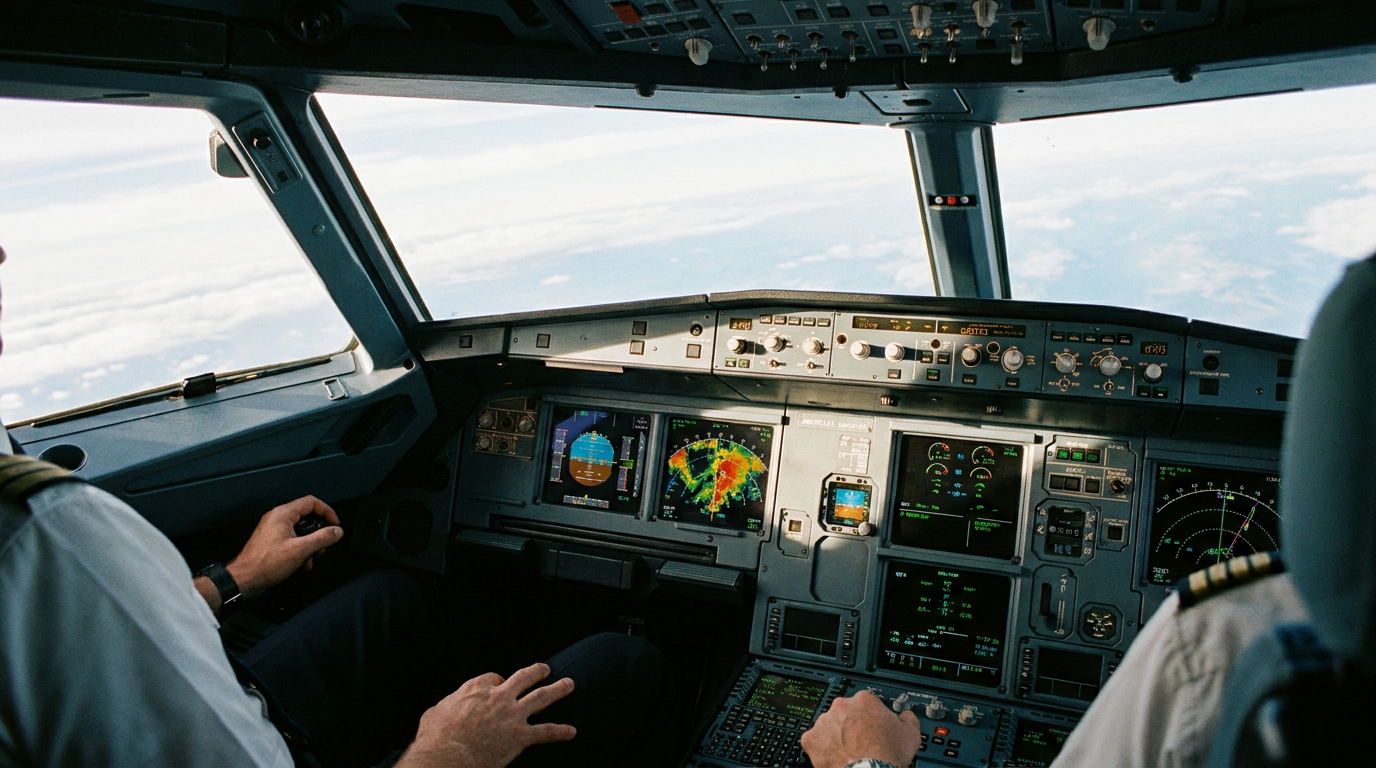
Lufthansa has similarly rolled out the technology across its A320, A330, and B787 fleets. By displaying color-coded turbulence zones directly on cockpit navigation screens, the system provides pilots with a highly accurate situational picture, allowing them to proactively route around the worst air.[3]
While software predicts where turbulence might be, aerospace engineers are developing hardware to see exactly where it is. The frontier of this effort is forward-looking LIDAR, or Light Detection and Ranging, which aims to give aircraft their own localized detection bubbles.[5][6]
Traditional weather radar bounces radio waves off water droplets or ice crystals. Because clear-air turbulence lacks moisture, radar beams pass right through it. LIDAR solves this by shooting short pulses of ultraviolet laser light from the nose of the aircraft directly into the flight path.[4][5][7]

These lasers reflect off microscopic dust particles and aerosols suspended in the clear air. By measuring the Doppler shift—the change in the frequency of the returning light—an optical sensor can calculate the velocity of those particles. If the system detects pockets of air moving at drastically different speeds right next to each other, it flags the invisible shear zone ahead.[7]
The Japan Aerospace Exploration Agency and Boeing successfully tested a prototype LIDAR system on a 777 aircraft, proving the concept in real-world conditions. Aviation regulatory groups are now conducting feasibility studies to establish operational standards for airborne LIDAR, targeting a reliable detection range of 12 nautical miles.[6][7]
At cruising speeds, a 12-nautical-mile range gives the flight crew roughly 60 seconds of advance warning. While a minute is rarely enough time to alter the flight path, it provides the critical window needed to illuminate the seatbelt sign, secure loose galley carts, and ensure passengers and crew are safely strapped in before the shaking begins.[6][7]
In the future, forward-looking LIDAR could be wired directly into an aircraft's fly-by-wire system. Just as a modern car's stability control automatically brakes individual wheels when it detects a skid, an advanced autopilot could use LIDAR data to rapidly deflect the plane's control surfaces, counteracting the specific aerodynamic loads of the incoming gust before the passengers even feel it.[5]

Beyond safety and comfort, predicting turbulence has a massive environmental upside. When pilots lack precise data, they often request sweeping altitude changes to hunt for smoother air, burning excess fuel in the process. By pinpointing exactly where the rough air begins and ends, AI and laser systems allow aircraft to maintain optimal flight levels, saving millions of gallons of jet fuel and significantly reducing the industry's carbon footprint.[1][3][4]
How we got here
1940s
Airlines begin relying on PIREPs (Pilot Reports) to manually radio turbulence locations to trailing aircraft.
2018
JAXA and Boeing successfully test a prototype forward-looking LIDAR system on a 777 to detect clear-air turbulence.
2020
The RTCA initiates feasibility studies for establishing operational standards for airborne LIDAR systems.
2024
A severe clear-air turbulence incident on a Singapore Airlines flight accelerates industry demand for predictive technology.
2025
IATA's Turbulence Aware program sees massive adoption, generating nearly 25 million live reports in six months.
Viewpoints in depth
Commercial Airlines' view
Airlines view predictive turbulence technology as a dual-purpose investment for safety and sustainability.
Airlines view turbulence not just as a safety hazard, but as a major operational inefficiency. Unpredictable rough air forces pilots to make conservative altitude changes, which burns excess fuel and disrupts schedules. For carriers, the integration of AI and crowdsourced data protects passengers and crew from injury while simultaneously optimizing flight paths to reduce carbon emissions and operational costs.
Aerospace Engineers' view
Engineers are focused on hardware solutions that can physically neutralize turbulence.
For engineers, the ultimate goal is removing human reaction time from the equation entirely. While predictive software is an excellent stopgap, the engineering community is focused on forward-looking LIDAR. By integrating laser detection directly into an aircraft's fly-by-wire system, they envision a future where the plane's control surfaces automatically micro-adjust to counteract incoming gusts, neutralizing the physical forces of turbulence before the cabin even registers a bump.
Aviation Meteorologists' view
Scientists warn that climate change is fundamentally altering the stability of the upper atmosphere.
Atmospheric scientists emphasize that the baseline conditions of the sky are fundamentally changing. Driven by a warming climate and shifting jet streams, the sheer volume of clear-air turbulence is expanding. Meteorologists argue that historical weather models are no longer sufficient, making real-time, machine-learning-driven data collection absolutely critical to understanding and navigating the increasingly volatile upper atmosphere.
What we don't know
- It remains unclear how quickly forward-looking LIDAR systems can be miniaturized and made cost-effective enough for fleet-wide commercial adoption.
- While AI models are highly accurate at predicting regional turbulence, forecasting hyper-localized, micro-scale air pockets remains a meteorological challenge.
Key terms
- Clear-Air Turbulence (CAT)
- Severe, invisible rough air that occurs in cloudless regions, making it undetectable by traditional weather radar.
- Eddy Dissipation Rate (EDR)
- A universal, aircraft-independent metric used to calculate the absolute intensity of atmospheric turbulence.
- LIDAR
- Light Detection and Ranging, a technology that uses pulsed laser light to measure distances and detect invisible particles in the air.
- Fly-by-wire
- An electronic flight control system that replaces conventional manual flight controls with an electronic interface.
Frequently asked
Can traditional weather radar see turbulence?
Traditional radar bounces radio waves off moisture, like rain or ice crystals. It cannot detect clear-air turbulence, which occurs in dry, cloudless air.
How do iPads detect turbulence?
Specialized software taps into the iPad's built-in accelerometer, translating the physical shaking of the device into precise, real-time turbulence data that is shared with other aircraft.
Will lasers stop the plane from shaking?
Currently, LIDAR provides a 60-second warning to secure the cabin. In the future, it could be linked to the autopilot to automatically adjust the wings and smooth out the ride.
Sources
Source coverage
7 outlets
3 viewpoints surfaced


[1]Aerospace Global NewsCommercial Airlines
Emirates employs multi-layered AI strategy to mitigate turbulence
Read on Aerospace Global News →[2]GlobeTrenderCommercial Airlines
Emirates uses AI to better predict severe turbulence
Read on GlobeTrender →[3]Lufthansa GroupCommercial Airlines
Lufthansa introduces turbulence warning system
Read on Lufthansa Group →[4]AI JournalCommercial Airlines
How AI is transforming aviation operations
Read on AI Journal →[5]PhotonicsAerospace Engineers
Forward-Looking Lidar for Aircraft
Read on Photonics →[6]RTCAAerospace Engineers
Feasibility Study on Airborne LIDAR for Clear Air Turbulence
Read on RTCA →[7]AZO OpticsAerospace Engineers
Lidar System to Detect Clear-Air Turbulence
Read on AZO Optics →


Every angle. Every day.
Get travel stories with full source coverage and perspective breakdowns delivered to your inbox.