How AI and Satellite Tech Are Predicting—and Preventing—Amazon Deforestation
Artificial intelligence models are analyzing satellite data to predict where illegal logging will happen before it starts, contributing to a massive drop in Amazon forest clearing.
By Factlen Editorial Team
- Conservation Technologists
- Focus on using machine learning to shift environmental protection from reactive to predictive.
- Enforcement Agencies
- Value AI as a resource multiplier that allows them to target limited police forces effectively.
- Indigenous Forest Guardians
- Utilize predictive tech and drones to defend their ancestral lands and maintain sovereignty.
- Ecological Restoration Sector
- Leverage algorithms to rebuild ecosystems efficiently and ensure long-term survival of planted forests.
What's not represented
- · Local agricultural workers who rely on land clearing for subsistence farming.
- · Commercial cattle ranchers navigating the new enforcement landscape.
Why this matters
By shifting from reactive monitoring to predictive intelligence, conservationists and law enforcement are stopping environmental destruction before it happens. This technological leap offers a scalable blueprint for protecting the world's remaining vital ecosystems.
Key points
- Amazon deforestation dropped by 61% in May 2026 compared to the previous year.
- AI platforms like PrevisIA predict where illegal logging will occur by detecting unofficial dirt roads.
- Predictions are highly accurate, with 80–85% of deforestation happening within 4km of flagged areas.
- Targeted enforcement using satellite data has reduced deforestation by 43% in key municipalities.
- Indigenous groups are using AI alerts and drones to intercept loggers before land is cleared.
- AI is also optimizing reforestation by prescribing the best native species for degraded soils.
The Amazon rainforest is witnessing a dramatic and measurable shift in its fight for survival. According to satellite data from May 2026, deforestation in the Brazilian Amazon plummeted by 61% compared to the same month the previous year. Over the past 12 months, clearing has reached its lowest point in more than a decade.[1]
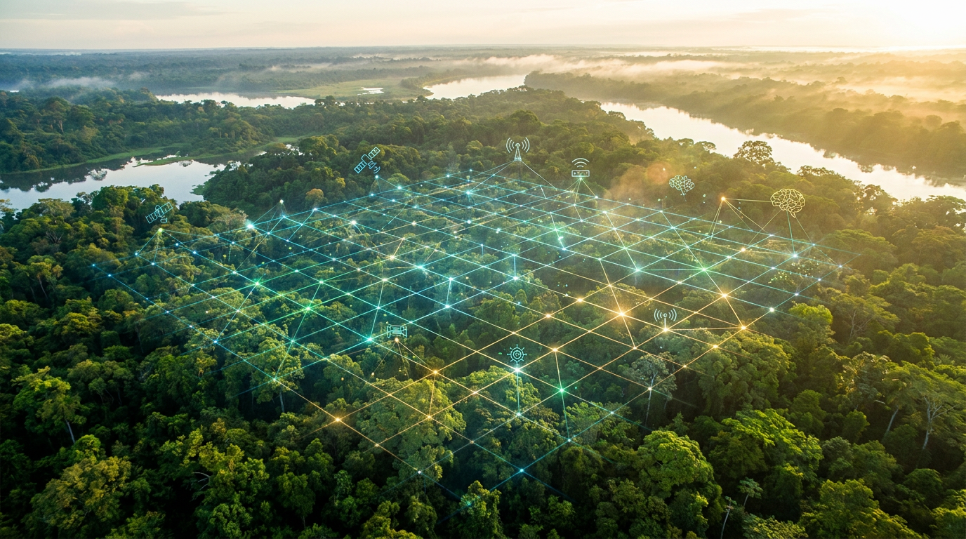
While renewed political will and stricter environmental governance have played massive roles in this decline, a quiet technological revolution is serving as the engine behind these gains. Artificial intelligence and advanced satellite monitoring have fundamentally transformed forest protection from a reactive autopsy into a predictive science.[1][2]
For decades, authorities relied on satellite imagery to see where trees had already fallen. By the time enforcement agents arrived at a flagged coordinate, the chainsaws were silent, the timber was gone, and the damage was irreversible. The system was necessary, but it was inherently a step behind the criminals.[3][4]
Now, platforms like PrevisIA are predicting where those chainsaws will strike next. Developed collaboratively by the Amazon Institute of People and the Environment (Imazon), Microsoft, and Fundo Vale, the AI-driven platform generates heat maps of imminent risk, allowing authorities to intervene before a single tree is cut.[2][4][7]

The AI algorithm achieves this by ingesting vast amounts of satellite data and specifically hunting for "unofficial roads." These clandestine dirt tracks, which are entirely invisible on official maps, serve as the primary arteries for illegal logging, wildcat mining, and unauthorized land grabbing.[4][7]
By combining the detection of these new roads with topography, socio-economic data, and historical clearing patterns, PrevisIA calculates exactly where the forest is most vulnerable. The accuracy of these models is staggering: researchers note that between 80% and 85% of actual deforestation occurs within a 4-kilometer radius of the AI's high-risk predictions.[4][8]
This predictive power fundamentally changes the calculus for law enforcement. Instead of chasing ghosts across millions of square kilometers, agencies like Brazil's environmental protection agency (IBAMA) and state prosecutors can deploy their limited resources to high-risk zones preventatively, catching offenders red-handed or deterring them entirely.[2][5]
This predictive power fundamentally changes the calculus for law enforcement.
The impact of this targeted approach is highly quantifiable. A study by University of Toronto researchers found that combining satellite monitoring with location-based, rapid-response enforcement reduced deforestation by 43%. This optimized strategy alone was responsible for cutting carbon emissions by nearly 50 million tons.[5]
It is not just federal agents wielding these new tools. Deep in the Amazon, Indigenous forest guardians are pairing AI predictions with their own on-the-ground technology. The Shanenawa people, for example, use drones and GPS monitoring in tandem with AI alerts to patrol their ancestral territories.[3]

When the algorithms flag a likely incursion by cattle ranchers or illegal loggers near their borders, local communities can deploy drones to verify the threat and nip the incursion in the bud before heavy machinery can be brought in.[3]
Beyond prediction, rapid-response systems like the Brazilian space agency's DETER program provide daily alerts of new clearings. While PrevisIA looks to the future, DETER ensures that any clearing that does begin is flagged almost immediately, allowing authorities to intervene within days rather than months.[1][4]

The technology is also being deployed to reverse historical damage. Ecological restoration companies like Re.green are using AI algorithms to analyze soil data, topography, and satellite imagery to determine the most effective reforestation techniques for degraded land.[6]
By prescribing specific native species and planting methods for distinct micro-environments—sometimes executed by autonomous drones dropping seeds in remote areas—these AI models maximize the survival rate of new forests and ensure the restored ecosystems closely mimic primary forests.[6]

Despite these massive technological leaps, the system is not foolproof. AI models are only as good as the data they receive, requiring continuous funding, robust cloud computing infrastructure, and, crucially, the political will to act on the intelligence provided.[2][5]
Furthermore, climate change introduces variables that algorithms struggle to control. Scientists warn that severe El Niño patterns and rising global temperatures make degraded forests highly flammable. This means that fires set for pasture management can easily escape into standing forests, causing severe damage even if intentional clear-cutting continues to drop.[1]
How we got here
2004
Brazil launches the DETER rapid-response satellite system to issue alerts on new forest clearings.
2008
Imazon creates the Deforestation Alert System (SAD) to independently monitor forest degradation.
2021
PrevisIA is launched by Imazon, Microsoft, and Fundo Vale to predict future deforestation risks using AI.
2024
Studies confirm that targeted satellite enforcement reduces deforestation by 43%.
May 2026
Satellite data reveals a 61% year-over-year drop in May deforestation, marking a 12-month low.
Viewpoints in depth
Conservation Technologists
Focus on the power of data to shift environmental protection from reactive to predictive.
For developers at organizations like Imazon and MapBiomas, the breakthrough lies in anticipation. By training machine learning models to recognize the precursors of deforestation—such as the sudden appearance of unofficial dirt roads—they can forecast destruction before it happens. They argue that AI's ability to process decades of satellite imagery and detect microscopic changes in the canopy provides a level of foresight that human analysts could never achieve manually, fundamentally changing the timeline of conservation.
Enforcement Agencies
Value the technology as a resource multiplier that makes policing vast territories possible.
Environmental protection agencies and state prosecutors view AI as a critical logistical tool. Policing the Amazon, an area roughly the size of the contiguous United States, is historically impossible with limited personnel. By receiving high-probability heat maps of where illegal logging will occur next, agencies can deploy agents strategically. This targeted approach not only catches offenders in the act but serves as a powerful deterrent, proving that the forest is actively watched.
Indigenous Forest Guardians
Utilize predictive tech to defend their ancestral lands and maintain territorial sovereignty.
For Indigenous communities like the Shanenawa, AI and satellite alerts are modern tools for an ancient mission. Rather than waiting for government intervention—which can sometimes be delayed by bureaucracy—local forest agents use AI risk maps alongside consumer drones to patrol their own borders. This allows them to identify incursions by wildcat miners or ranchers early, confronting the threat or gathering irrefutable evidence before their land is irreparably scarred.
Ecological Restoration Sector
Leverage algorithms to rebuild ecosystems efficiently and ensure long-term survival of planted forests.
Companies focused on reversing deforestation argue that planting trees is not enough; they must plant the right trees in the right places. By using AI to analyze soil composition, historical biodiversity, and micro-climates, restoration firms can prescribe specific native species for different patches of degraded land. This data-driven approach maximizes the survival rate of the seedlings and ensures the resulting forest mimics the complex ecosystem of the primary Amazon, rather than becoming a sterile monoculture.
What we don't know
- Whether the current levels of funding for satellite monitoring and AI development will be sustained through future political administrations.
- How severely upcoming El Niño events and climate-driven droughts will impact forest flammability, potentially offsetting enforcement gains.
Key terms
- PrevisIA
- An artificial intelligence platform that analyzes satellite data to forecast areas at high risk of future deforestation in the Amazon.
- DETER
- A rapid-response satellite monitoring system run by Brazil's space agency that detects new forest clearings in near real-time.
- Unofficial Roads
- Clandestine dirt tracks built by illegal loggers and miners, which serve as early indicators of future deforestation.
- MapBiomas
- A collaborative network that uses satellite imagery and machine learning to map land use and land cover changes across Brazil.
- El Niño
- A climate pattern that typically brings hotter, drier conditions to the Amazon, increasing the risk of severe forest fires.
Frequently asked
How does AI predict deforestation?
AI algorithms analyze satellite imagery to detect 'unofficial roads'—clandestine dirt tracks built by loggers. By combining this with topography and socio-economic data, the AI forecasts where clearing is most likely to happen next.
Is deforestation in the Amazon actually decreasing?
Yes. Satellite data from May 2026 showed a 61% drop in deforestation compared to the previous year, bringing the 12-month clearing total to its lowest point in over a decade.
How accurate are these AI predictions?
Highly accurate. Researchers have found that between 80% and 85% of actual deforestation occurs within a 4-kilometer radius of the high-risk zones flagged by the AI.
How are Indigenous groups using this technology?
Communities like the Shanenawa use AI risk alerts in combination with consumer drones and GPS to patrol their lands, allowing them to intercept illegal loggers before heavy machinery arrives.
Sources
Source coverage
8 outlets
4 viewpoints surfaced


[1]MongabayEnforcement Agencies
Satellite alerts suggest deforestation in the Brazilian Amazon is continuing to fall
Read on Mongabay →[2]UNEPConservation Technologists
How artificial intelligence is helping save the Amazon
Read on UNEP →[3]Positive NewsIndigenous Forest Guardians
AI tools harness the power of data to protect lands from deforestation
Read on Positive News →[4]FAPESPConservation Technologists
Artificial intelligence, satellite data, and statistical models are used to predict the risk of deforestation
Read on FAPESP →[5]University of TorontoEnforcement Agencies
Satellite monitoring technology is helping to protect Brazil's Amazonian rainforest
Read on University of Toronto →[6]Egypt IndependentEcological Restoration Sector
Re.green wants to restore lost forests in a financially viable way
Read on Egypt Independent →[7]Smart Forests AtlasConservation Technologists
PrevisIA: Predicting areas at risk of deforestation
Read on Smart Forests Atlas →[8]Resoil FoundationEcological Restoration Sector
Is it possible to prevent deforestation using artificial intelligence?
Read on Resoil Foundation →
Every angle. Every day.
Get world stories with full source coverage and perspective breakdowns delivered to your inbox.