The AI Demining Revolution: How Drones and Machine Learning Are Clearing the World's Minefields
Humanitarian organizations and defense startups are deploying AI-powered drones and predictive algorithms to accelerate landmine clearance, turning a centuries-long challenge into a solvable problem.
By Factlen Editorial Team
- Humanitarian Deminers
- Focus on community safety, returning land to farmers, and the rigorous standard of proving an area is 100% clear.
- Defense Tech Innovators
- Focus on sensor fusion, machine learning accuracy, and scaling autonomous systems to replace human sappers.
- Academic & Field Researchers
- Focus on evidence-based risk modeling, reducing false positive rates, and measuring the socioeconomic impact of clearance.
- Factlen Editorial Team
- Synthesizes the evidence to evaluate the maturity and real-world impact of AI demining technologies.
What's not represented
- · Local farmers awaiting land clearance
- · Civilian victims of unexploded ordnance
Why this matters
Unexploded landmines trap millions of people in poverty by rendering agricultural land unusable and preventing post-conflict rebuilding. By accelerating clearance with AI, communities can safely return home, plant crops, and rebuild their local economies decades sooner than previously thought possible.
Key points
- Global demining efforts are shifting from manual metal detectors to AI-powered drone mapping.
- Multi-sensor fusion allows AI to distinguish between harmless scrap metal and actual explosives.
- Predictive machine learning models have reduced false alarms and clearance times by up to 50 percent in field tests.
- Real-time computer vision can identify surface landmines with a miss rate of less than 1.6 percent.
- Accelerating land clearance directly correlates with increased local economic growth and foreign aid investment.
The global landmine crisis represents one of the most enduring and lethal hangovers of modern warfare. Across more than 70 countries, an estimated 110 million unexploded landmines remain buried in fields, forests, and urban centers. For decades, the process of removing these hidden threats has been agonizingly slow, relying on methods that have barely evolved since the mid-twentieth century.[8]
Traditionally, humanitarian demining requires sappers to crawl centimeter by centimeter through contaminated zones, sweeping handheld metal detectors over the soil. It is a dangerous, labor-intensive process where a single misstep can be fatal. At the current pace of manual clearance, experts estimate it would take centuries to fully demine the planet.[8]
However, a paradigm shift is underway. Humanitarian organizations, academic researchers, and defense technology startups are increasingly deploying artificial intelligence, multi-sensor drones, and predictive machine learning to fundamentally change the mathematics of mine clearance. By treating demining as a data problem, these groups are turning a centuries-long challenge into a solvable, near-term objective.[8]
The most immediate breakthrough in AI demining is the accelerated "cancellation" of safe land. In humanitarian mine action, the most time-consuming phase is often proving that a suspected field is actually empty.[1][7]
To solve this, organizations like The HALO Trust have partnered with technology giants to process vast amounts of satellite and drone imagery. By feeding this geospatial data into advanced AI models, deminers can forensically map areas and cancel suspected hazard zones without ever sending human teams into the brush.[1][7]
In Ukraine, which is currently considered the most heavily mined country in the world, this technique has yielded massive efficiency gains. Using AI-assisted mapping, demining teams have already identified 13,000 danger zones and confirmed them as completely safe for civilian and agricultural use.[7]

Beyond mapping, multi-sensor fusion is helping deminers overcome the primary limitation of traditional metal detectors: false positives. In high-conflict areas, standard detectors trigger alarms on every piece of buried scrap metal or artillery shrapnel, forcing sappers to manually excavate thousands of harmless objects for every actual mine they find.[5][7]
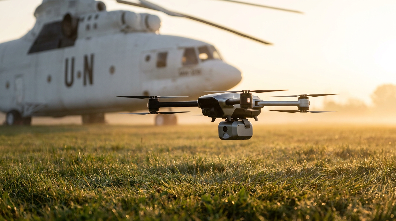
Defense startups are addressing this by equipping commercial drones with an array of advanced sensors, including RGB cameras, infrared thermography, LiDAR, and Ground Penetrating Radar. These drones fly autonomously over suspected minefields, collecting high-resolution subsurface data.[5]
This multi-layered data is then fed into proprietary AI models. One such system, developed by Dropla Tech and trained on over a million field images, color-codes surveyed zones from safe to high-risk. The system currently operates at roughly 80 percent accuracy, allowing human teams to bypass harmless shrapnel and focus exclusively on genuine explosive signatures.[5]
This multi-layered data is then fed into proprietary AI models.
Machine learning is also being deployed predictively to identify high-risk clusters before drones even take flight. By analyzing historical conflict data, troop movements, and geographical features, algorithms can predict where mines were most likely laid.[3]
Researchers at Carnegie Mellon University, in partnership with the United Nations Mine Action Service, developed a predictive model known as the RELand system. The software uses interpretable invariant risk minimization to identify cohesive hazard clusters while accounting for the logistical budgets of demining NGOs.[3]
During field tests in Colombia and Afghanistan, the RELand system successfully reduced false alarms and overall clearance time by 50 percent. By guiding non-technical survey teams to the highest-probability areas, the software directly led to the discovery of new landmines that might otherwise have remained hidden.[3]

For unexploded ordnance sitting above ground, deep learning models are enabling real-time surface detection at speeds that surpass human capability.[4]
A recent peer-reviewed study demonstrated the effectiveness of integrating YOLOv8 computer vision models into mobile demining robots. The system leverages optical imaging and artificial intelligence to scan the environment for specific explosive shapes.[4]
In rigorous testing, the model successfully identified common surface threats, such as PFM-1 "butterfly" mines, processing the visual feed at 2.6 frames per second. The system proved highly reliable, missing at most 1.6 percent of targets, proving that AI can serve as an effective, tireless spotter for human operators.[4]
The urgency behind these technological breakthroughs is tied directly to the economic benefits of releasing land back to communities. Demining is not just a safety measure; it is a prerequisite for post-conflict recovery.[6]
A comprehensive study analyzed the macroeconomic impact of landmine clearance in Afghanistan by measuring nighttime light emissions visible in satellite imagery—a proven proxy for local economic growth.[6]
The researchers found that districts with active clearance operations experienced tangible increases in economic livelihoods. Furthermore, areas that were successfully demined were significantly more likely to receive international foreign aid in subsequent years, highlighting how clearance acts as a catalyst for broader development.[6]

Despite these remarkable advancements, experts emphasize transparent uncertainty regarding the current limits of artificial intelligence. AI is not yet a fully autonomous silver bullet, and the demining sector remains understandably cautious about removing human verification entirely.[7]
Current AI models still struggle with deeply buried mines, varying soil moisture, and dense vegetation canopies that obscure aerial sensors. In highly contaminated battlefields, the sheer volume of metal shrapnel can still overwhelm even the most advanced algorithms, requiring human sappers to make the final call.[7]
While fully robotic, autonomous clearance remains a long-term goal, artificial intelligence has already revolutionized the triage and detection phases of humanitarian demining. By acting as a powerful force multiplier, machine learning is ensuring that sappers only step into areas where the danger is real, saving both invaluable time and countless lives.[8]
How we got here
1988
The HALO Trust is founded, relying primarily on manual clearance and metal detectors.
2022
The conflict in Ukraine creates the world's most heavily mined country, accelerating the need for new clearance technologies.
2023
AidData publishes research proving that landmine clearance directly drives measurable economic growth.
2024
Researchers successfully test real-time deep learning models capable of identifying surface landmines via mobile devices.
2025
Defense startups raise millions to scale multi-sensor drones and AI risk-mapping software for frontline deployment.
Viewpoints in depth
Humanitarian Deminers
Focus on community safety, returning land to farmers, and the rigorous standard of proving an area is 100% clear.
For organizations like The HALO Trust, the primary value of AI is not just finding mines, but proving where they are not. By using satellite and drone imagery to 'cancel' suspected hazard areas, deminers can quickly return safe land to farmers and displaced civilians. Their ultimate metric is community recovery, and they maintain a cautious approach to full automation, insisting that technology must meet a near-perfect safety standard before replacing human verification.
Defense Tech Innovators
Focus on sensor fusion, machine learning accuracy, and scaling autonomous systems to replace human sappers.
Startups and defense contractors view the landmine crisis as a data and robotics problem. By fusing inputs from RGB cameras, LiDAR, and Ground Penetrating Radar, they aim to build predictive models that remove humans from the detection loop entirely. Their goal is to iterate rapidly, accepting that while current AI models sit at roughly 80% accuracy, massive datasets will eventually enable fully autonomous, expendable robotic clearance fleets.
Academic & Field Researchers
Focus on evidence-based risk modeling, reducing false positive rates, and measuring the socioeconomic impact of clearance.
Researchers approach demining through the lens of statistical optimization and economic impact. Teams at institutions like Carnegie Mellon University prioritize building interpretable machine learning models that optimize limited humanitarian budgets by cutting false alarm rates. Meanwhile, economists measure the downstream effects of these technologies, proving that faster clearance directly correlates with increased foreign aid and local economic revitalization.
What we don't know
- When fully autonomous robotic clearance will be reliable enough to operate without human verification.
- How well current AI models will adapt to deeply buried mines in heavily forested or waterlogged terrain.
- Whether the cost of advanced multi-sensor drones can be scaled down enough for universal use by underfunded NGOs.
Key terms
- Ground Penetrating Radar (GPR)
- A sensor technology that uses radar pulses to image the subsurface, detecting buried objects without digging.
- Unexploded Ordnance (UXO)
- Explosive weapons, such as bombs, shells, and landmines, that did not explode when they were deployed and still pose a risk.
- Non-Technical Survey
- The initial phase of demining where teams gather information and map suspected hazard areas before deploying physical detection equipment.
- False Positive
- A test result that incorrectly indicates the presence of a landmine, usually caused by harmless scrap metal.
- YOLOv8
- A state-of-the-art, real-time object detection algorithm used in computer vision to quickly identify specific shapes in images.
Frequently asked
Can artificial intelligence physically remove landmines?
No. Currently, AI is used to map minefields and identify safe zones. Physical removal still requires human sappers or remote-controlled robotic vehicles.
Why are traditional metal detectors considered inefficient?
Metal detectors trigger false alarms on every piece of buried scrap metal or shrapnel, forcing deminers to manually excavate harmless debris.
How do drones detect buried explosives from the air?
Drones use a combination of sensors, including Ground Penetrating Radar (GPR) and thermal imaging, which AI analyzes for soil anomalies and explosive chemical signatures.
Is AI demining technology fully autonomous yet?
Not yet. The complexity of terrain, dense vegetation, and varying soil moisture means human verification is still required before land is declared safe.
Sources
Source coverage
8 outlets
4 viewpoints surfaced


[1]The HALO TrustHumanitarian Deminers
Eradicating landmines with drones and AI
Read on The HALO Trust →[2]UNDPHumanitarian Deminers
AI for demining: Ukrainian innovators train algorithms to detect explosives in drone images
Read on UNDP →[3]Carnegie Mellon UniversityAcademic & Field Researchers
RELand: Risk Estimation of Landmines via Interpretable Invariant Risk Minimization
Read on Carnegie Mellon University →[4]MDPI Remote SensingAcademic & Field Researchers
Deep learning-based real-time detection of surface landmines using optical imaging
Read on MDPI Remote Sensing →[5]ForbesDefense Tech Innovators
Sappers Will Get Robotic Support
Read on Forbes →[6]AidDataAcademic & Field Researchers
Landmine Clearance and Economic Development
Read on AidData →[7]National Defense MagazineDefense Tech Innovators
Boosting landmine clearance with field-focused workflows
Read on National Defense Magazine →[8]Factlen Editorial TeamFactlen Editorial Team
Synthesis by Factlen editorial team
Read on Factlen Editorial Team →
Every angle. Every day.
Get defense security stories with full source coverage and perspective breakdowns delivered to your inbox.